





The gigantic fires that have broken out in recent days in France and Spain, forcing tens of thousands of people to evacuate, are creating their own weather, and in both countries, firefighters watch helplessly as a phenomenon forms, with varying intensity, that is contributing to making them so difficult to extinguish: These are pyrocumulus clouds. “They are clouds that, as the prefix pyro, indicates, are generated by fire. In fact, their technical name is flammagenitus”, says Rubén del Campo, spokesperson for the State Meteorological Agency (Aemet).
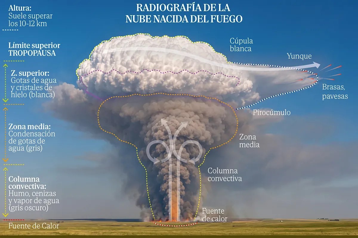
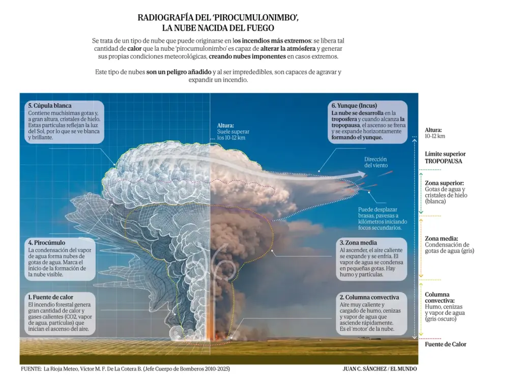
How do they form? “During these very large and powerful fires, so much energy is released that convective updrafts are generated that are capable of rising to areas of the atmosphere where temperatures are already low enough for the water vapor that may be in the forest to reach those high levels, condense, and form these clouds,” Del Campo explains in a phone conversation.
They are a type of vertically developing cloud, like normal cumulonimbus clouds, that is, “the usual storm clouds that typically form under normal conditions, from midday and especially in summer, when there is atmospheric instability. They grow and if they develop enough, they can give rise to storm showers,” says Del Campo.
But, as Mar Gómez, meteorologist at eltiempo.es, describes, pyrocumulus clouds form “from the fire’s own heat” and from “columns through which smoke, water vapor, ashes, and particles rise, as if it were a giant chimney.” The appearance of these columns serves as an indicator that “the fire is releasing a lot of energy and can generate more dangerous behavior.”
Sometimes, “if these pyrocumulus clouds develop enough, they can cause very strong wind gusts and downbursts, that is, very intense wind gusts that can spread the fire more intensely and greatly hinder extinguishing efforts,” adds Del Campo. “They are capable of generating their own meteorological conditions. They can cause lightning, which can lead to new fire outbreaks and sometimes even small showers, but in general, what causes the most problems is that they give rise to intense and unpredictable wind gusts,” he notes about this phenomenon that has formed in the large fire in southern France and those in central Spain.
“Sudden wind changes occur, secondary fire spots caused by embers and, in extreme cases, an even more powerful cloud – called a pyrocumulonimbus – capable even of producing lightning and favoring new fires,” says Mar Gómez.
According to French authorities, the fires in southern France have generated this type of cloud that occurs when the pyrocumulus reaches large dimensions and causes a storm, the so-called pyrocumulonimbus clouds.
Being capable of generating storms and wind changes, they make extinguishing tasks very dangerous and almost impossible. “We had never faced anything like this before”, admitted Lieutenant Colonel Eric Brocardi, spokesperson for the French firefighters, who recalls how the megafires in Australia and Canada this decade served as a warning. “The clouds created by the fire create their own climate, and the fire’s behavior becomes totally unpredictable. The only way to face this monster is with a massive attack, with a fleet of planes that will have to be operational five months a year.”
“It’s as if the fire had a life of its own,” commented Interior Minister Laurent Núñez on the ground, an exceptional witness to the Gironde fire that has burned 42,000 hectares of pine forests and scrubland in less than a week and forced the evacuation of more than 220,000 people in southwestern France, with flames 15 kilometers from Bordeaux.
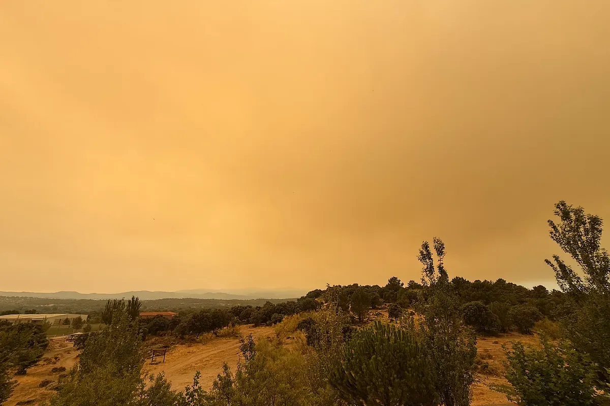
According to Del Campo, pyrocumulus clouds, which are more frequent, have formed in the fires ravaging central Spain these days.
A rapid advance
For Theodore Keeping, fire analysis specialist at Imperial College London, the fires unleashed this summer in Spain and France are “undoubtedly the most extreme we have had to date in Europe due to their size,” because of the extent of their spread and their ability to create this type of cloud.
“The especially hot and dry summer we are having has created the conditions for this phenomenon to occur,” warns Keeping. “The succession of hot and windy days makes the fire advance faster until the vegetation is consumed. And when this intensity reaches its maximum, that is when pyrocumulonimbus systems form that fan the fire with even stronger winds.”
“Climate change is causing these conditions that will make fires in Europe increasingly likely and intense,” says the British expert, warning of impacts on the population and the economy, as well as health risks (it is estimated that exposure to wildfire smoke causes 100,000 deaths a year).
Australia was one of the first countries where pyrocumulonimbus formation was detected early this century, very visible in the 2023 wave of fires. That same year they occurred in Canada, in some of the more than 6,000 fires that burned over 15 million hectares. During the wave of fires that ravaged California in 2021, there were also several similar episodes. That same year, it is estimated that there were 83 pyrocumulonimbus formations worldwide.
The World Meteorological Organization defines pyrocumulonimbus clouds as “giant storm clouds created by the extreme heat of a large wildfire”. NASA, in one of its first analyses of the phenomenon, poetically described them as “the cloud dragon that spits fire,” capable of channeling columns of smoke into the atmosphere while discharging lightning, wind, and rain over the Earth’s surface.